
Most people have no idea where their nearest emergency shelter is. They don’t know which hospital has an ER versus urgent care only, where the closest emergency supply store is, or where their county’s emergency management office posts live updates. They’ll find out during a crisis — by searching on a phone with 12% battery while the cell network is overwhelmed.
Pre-mapping your local emergency resources takes about two hours and requires no special skills. It produces something more useful than any app: a printed, annotated reference that works when the internet doesn’t. This article walks you through exactly how to do it.
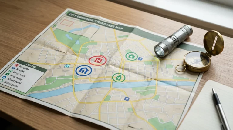
The 9 Local Resources Every Family Should Know
| Resource Type | Why It Matters | How to Find It |
|---|---|---|
| Emergency shelters | Mandatory evacuation or displacement | County emergency management website |
| Hospitals with ER | Serious injuries, cardiac events, burns | Google Maps, county health department |
| Urgent care centers | Non-life-threatening injuries when ER is overwhelmed | Google Maps, insurance provider site |
| Fire stations | Know response coverage zones; mutual aid locations | City/county fire department website |
| Police stations | Reporting, assistance, security during civil unrest | City website |
| Emergency supply stores | Last-minute gear, fuel cans, batteries | Google Maps — note hours and stock types |
| Fuel stations with generators | Fuel available during multi-day power outages | GasBuddy app; direct reconnaissance |
| County emergency management | Official orders, shelter openings, road closures | Search “[county name] emergency management” |
| Water distribution points | Boil-water orders, municipal supply disruption | City water utility website; county alerts |
A family of 4 with two adults should each independently know where at least the top five of these are. If only one parent holds this information and they’re unavailable, the family’s response capacity is cut in half.
How to Find Your Local Resources
Emergency Shelters
Your county’s Office of Emergency Management (OEM) or Emergency Services department is the authoritative source. Search “[your county] emergency management” or “[your county] emergency shelter locations.” Most counties publish shelter lists that activate for specific disaster types — flood shelters may differ from hurricane shelters or winter storm warming centers.
The Red Cross also maintains a shelter locator at redcross.org/find-shelter (or text SHELTER plus your ZIP code to 43362). The FEMA app shows shelter locations once a federal disaster declaration is issued, but that typically lags the actual emergency by 24–48 hours — don’t rely on it as your primary source.
Hospitals and Medical Facilities
Open Google Maps and search “emergency room” near your address. Take note of which facilities are full-service ERs versus freestanding emergency departments (which often can’t handle trauma) versus urgent care centers (which handle minor injuries but not cardiac events or major trauma).
For a family of 4, know at least two hospital ERs — one in your immediate area and one in an alternate direction. During a major regional emergency, your nearest hospital may be closed or overwhelmed. Having a second option on your printed list costs nothing and matters a lot when you’re making that decision at 2 a.m.
Fuel Stations with Generator Backup
This is the one most people don’t research until they’re sitting in a line that’s three hours long on day two of a power outage. Identify the gas stations near your home and evacuation routes that have backup generators. The easiest way to find them: call your local stations directly and ask, or check if your state has a Fuel Availability Program (Florida, Texas, and several other hurricane-prone states do). Many fuel stations post generator status on Google Maps during declared emergencies.
Alternatively, keep 5–10 gallons of stabilized fuel (use STA-BIL fuel stabilizer, about $10) in approved containers at home. A family vehicle with a full tank and 10 gallons in reserve can cover 400–500 miles without stopping — more than enough for most evacuation scenarios.
County Emergency Management Alerts
Sign up for your county’s emergency alert system before you need it. Most counties use one of three platforms: Everbridge, Rave Alert, or Code Red. Search “[your county] emergency alerts signup.” These push notifications to your phone via text, call, and app — they’re often the first source of mandatory evacuation orders, shelter openings, and road closure information.
In addition to county alerts, sign up for your state’s emergency management Twitter/X feed and bookmark the local National Weather Service office page. These three sources together give you redundant official information during most emergency scenarios.
Building Your Printed Emergency Resource Reference
Digital tools are excellent for pre-research and fail at precisely the moment you need them most. A printed reference doesn’t require battery, cell service, or internet. Build one now.
Format: A single laminated sheet (laminate pouches cost about $15 for 20 at any office supply store) or a page in a household binder. Include:
- Nearest emergency shelter: Name, address, distance from home
- Alternate shelter: Same info, different direction from home
- Hospital ER #1: Name, address, approximate drive time
- Hospital ER #2: Alternate route option
- Urgent care (closest 2): Name, address, hours
- Police non-emergency line: Number for non-911 situations
- County OEM website and phone: For official orders and updates
- Fuel stations with generators: 2–3 options, noting their addresses
- Nearest emergency supply store: Name, address, hours
- Water utility emergency line: For boil-water orders and outages
Make two copies: one posted inside a kitchen cabinet door and one in each vehicle’s glove compartment. Update it annually — shelter lists, hospital affiliations, and business hours change.
Digital Tools Worth Using for Pre-Research
These are useful for building your reference, not for relying on during an emergency:
- FEMA app (free): Shelter locator, weather alerts, disaster resources. Best use: checking shelter locations after a federal disaster declaration. Download it now so it’s on your phone with your location set.
- Google Maps offline maps: Download your county’s map for offline use. Go to Google Maps → your profile → Offline maps → Select an area → Download. Works without cell service. Costs about 100–200 MB of storage.
- 211 (United States): Dial 2-1-1 for a human operator who can connect you with local emergency resources, shelter information, and social services. Available in most of the U.S. 24/7 during declared emergencies. Add it to your contacts now.
- Nextdoor app: During local emergencies, neighbors post real-time ground-level information (road closures, shelter status, which stores have power) faster than official sources. Useful context, not authoritative — verify before acting on it.
Common Mistakes
- Relying entirely on digital sources. The 2011 Joplin tornado, 2012 Superstorm Sandy, and 2017 Hurricane Harvey all involved extended cell and internet outages. If your emergency resource knowledge lives only on your phone, it’s vulnerable to the same conditions that make the emergency an emergency. Print your reference.
- Knowing only one shelter location. Shelters reach capacity. Shelters specifically for flood zones may be unavailable in a wildfire scenario. Know at least two locations in different directions from your home.
- Assuming the ER will be open and available. During major regional emergencies, hospitals divert or close. Your nearest ER may be full. Your second option matters. Know it before you need it.
- Not including family members in the information. If both adults in a household know the resources but neither has communicated them to teenagers or older children, those family members can’t act independently in a scenario where parents are separated or unreachable. Share the printed reference explicitly.
- Failing to update the list. Emergency shelter networks change. Hospitals close ERs or merge. Set a calendar reminder for the same date every year to verify your resource list is still accurate. It takes 20 minutes.
FAQ
How do I find emergency shelters that accept pets?
FEMA and many states now require pet-friendly shelters under the PETS Act (2006), but not every jurisdiction has implemented this consistently. Search your county OEM website specifically for “pet-friendly shelter” or “pet-friendly emergency shelter.” The Humane Society’s Emergency Shelter Finder and RedCross.org both provide this information. If you have pets, identify a pet-friendly shelter in advance — standard shelters typically can’t accept animals, and finding this out at intake during an evacuation creates a real crisis within a crisis.
What if I have a family member with a medical device or disability?
Most counties have a Special Needs Registry or Access and Functional Needs (AFN) registry. Registering a household member with oxygen equipment, dialysis needs, powered mobility, or other medical requirements can trigger priority outreach during mandatory evacuations and access to special needs shelters with medical support. Search “[your county] special needs registry” or “[your county] AFN registry.” This is one of the highest-value preparedness steps for households with vulnerable members.
How do I stay updated on resource availability during an actual emergency?
In order of reliability during active emergencies: (1) County emergency alert texts/calls — sign up now. (2) Local TV news — sustained broadcast coverage during major emergencies even when cable/satellite fails, using over-the-air (antenna) signal. (3) NOAA weather radio on a battery-powered receiver. (4) Local radio stations (check which station your county uses for emergency broadcasts). (5) County emergency management social media. Ranked roughly by uptime during power and cell network disruption — local TV on an antenna receiver is more resilient than cell-dependent apps.
Is the 211 service reliable during emergencies?
211 is one of the more underrated emergency resources in the U.S. It’s a free, 24/7 human-answered service that connects callers with local resources — shelters, food, medical aid, utility assistance, and crisis services. Coverage is near-universal in the continental U.S. but varies in capability by state and county. During federally declared disasters, call volume surges and wait times increase, but it remains one of the few human-staffed, real-time resource connections available. Save it in your contacts now.
What’s the difference between the county OEM and FEMA?
Your county Office of Emergency Management (sometimes called Office of Emergency Services or Emergency Management Agency) is the primary responder for local emergencies. They open shelters, coordinate with local utilities, issue evacuation orders, and manage resources. FEMA is federal — it provides resources and funding when a disaster exceeds what state and local governments can handle, which typically means a formal presidential disaster declaration has been issued. For most local emergencies (localized flooding, power outages, wildfires), your county OEM is your primary official source. FEMA becomes more relevant in large-scale, multi-county, federally declared disasters.
Bottom Line: Knowing your local emergency resources before a disaster is a two-hour investment with permanent value. Map your nearest shelters, ERs, fuel stations, and county emergency management contacts now. Build a printed reference that works without power or cell service. Sign up for county emergency alerts. The families who navigate emergencies best are the ones who made these decisions before the emergency started — not the ones searching Google Maps on 12% battery.
Dan Lockland is a preparedness instructor and survival skills educator with over 15 years of hands-on experience. He shares practical, no-nonsense guidance on emergency preparedness, self-reliance, and sustainable living at PreparingWithDan.com.