
In a fast-moving emergency, the people who make good decisions early are the people who have better information than everyone else. Not more information — better. The difference between panic and action is usually whether you know what’s actually happening, where the threat is, and what’s safe to do next.
Your information network is the system you use to get that intelligence when the internet is down, the cell network is overloaded, and the news is three hours behind reality. Building it takes a few hours and about $100 in gear. Not building it means you’re stuck waiting for official updates that may never come.
The Information Stack: Four Layers, One Goal
A prepper information network isn’t one thing — it’s layers that back each other up. When the top layer fails, you drop to the next one.
| Layer | What It Provides | Works When |
|---|---|---|
| 1 — Internet/cell | News, official alerts, social media monitoring | Network is functional |
| 2 — NOAA weather radio | Government emergency alerts, severe weather, official advisories | Grid up, infrastructure intact |
| 3 — Radio monitoring (scanner, AM, ham nets) | Local emergency coordination, real-time ground truth | Cell/internet down, radio towers operational |
| 4 — Human network | Neighborhood intel, area conditions, mutual verification | Always — people are the most reliable backup |
Layer 1: Internet and Cell (While It Lasts)
When connectivity is working, use it aggressively to build situational awareness before it degrades.
Official Sources First
- FEMA alerts: wireless emergency alerts are broadcast directly to your phone — no app needed. Make sure your phone has Wireless Emergency Alerts enabled in settings.
- Local county emergency management website: bookmark it now. County emergency managers often post updates faster than national news for local events.
- National Weather Service (weather.gov): the source that every weather app and news outlet pulls from. Go directly to the source. Your county’s NWS page has the most localized forecast discussion available.
- Sign up for your county’s emergency alert system: free, takes two minutes. Text and email alerts go to you directly. Search “[your county name] emergency alerts” to find the signup page.
Social Media as a Secondary Source
Twitter/X and Facebook neighborhood groups can surface real-time reports that official channels haven’t confirmed yet. A dozen people posting that a road is flooded is actionable before the county tweets about it. But treat social media as leads to verify, not confirmed facts. Look for:
- Multiple independent reports of the same thing
- Photos or video that match what you know about the area
- Posts from local officials or verified emergency management accounts
Layer 2: NOAA Weather Radio
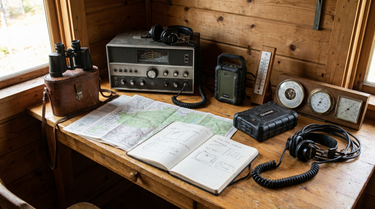
NOAA weather radio is the fastest, most reliable emergency alert channel in the United States. It broadcasts 24/7 from dedicated transmitters across the country. When a tornado warning is issued, a shelter-in-place order is given, or a local emergency is declared, it goes over NOAA radio first — faster than cell alerts, faster than news websites, faster than anything else.
- Midland WR400 Weather Alert Radio (~$50): Plugs into the wall, has battery backup, sounds an alarm specifically for your county when a watch or warning is issued. SAME (Specific Area Message Encoding) filtering means it only alerts for your county — not the 14 counties surrounding you. Keep one in the bedroom. A tornado warning at 3 AM without this means you may not know until it’s too late.
- Midland ER310 Emergency Crank Radio (~$50): Portable version. Receives NOAA, AM, FM, and shortwave. Hand-crank and solar charging, USB phone charging. This is the go-bag radio.
NOAA broadcasts on seven designated frequencies between 162.400 and 162.550 MHz. Any radio that receives these frequencies (including most GMRS radios and ham radios) can monitor them.
Layer 3: Radio Monitoring
Scanner Apps (Transitional Tool)
Scanner apps like Broadcastify stream police, fire, and EMS radio over the internet. Not useful when the internet is down, but extremely useful in the early hours of an emergency when internet is still working. You can hear what first responders are actually dealing with — where fires are, which roads are closed, what areas are being evacuated — before it hits the news. Free to use, $7/month for premium feeds.
Physical Scanner
For when internet is down but radio infrastructure is still working, a physical scanner lets you monitor police, fire, EMS, and local government frequencies directly.
- Uniden Bearcat BC125AT (~$60): Basic handheld scanner. Covers 25–512 MHz, 500 channels, easy to program. Good starting point for someone who wants local monitoring capability without significant investment.
- Uniden HomePatrol-2 (~$280): Digital trunking scanner. Programs automatically by zip code. Covers digital systems including P25, which many modern public safety agencies use. If your local agencies have gone digital, this is required — the BC125AT won’t receive them.
AM Radio During Disasters
AM frequencies travel farther than FM and often have redundant transmitters. Local AM news stations are frequently the most reliable broadcast source during a regional emergency — they stay on air, they have local reporters, and they often carry official emergency broadcasts. The Midland ER310 covers AM. Know which AM station in your area serves as the official emergency broadcaster.
Ham Radio Nets
Licensed amateur radio operators run emergency nets — organized check-in systems on designated frequencies — during disasters. These nets relay real-world conditions from operators across the affected area: which roads are passable, where shelters are open, where flooding is occurring. This is ground-truth information that no official channel aggregates in real time.
To participate (transmit), you need a Technician license (~2–4 weeks of casual study, $15 to test, no code required). To listen, you don’t need a license. A Baofeng UV-5R (~$25) or Yaesu FT-65R (~$100) can receive 2-meter and 70cm ham frequencies. Search “[your county/region] ARES” or “[region] emergency ham net” to find the local net frequencies to program in advance.
Layer 4: Your Human Intel Network
The most durable information source in any collapse of normal communication is people you trust who are geographically distributed around you. A 5-person network covering different parts of your area can give you better situational awareness than any technology stack.
Building the Network
You don’t need a formal prepper group. You need a handful of people who:
- Live in different parts of your area (different neighborhoods, different sides of the river or highway)
- Are observant and communicate clearly under stress
- Have agreed to check in with the group during emergencies and share what they’re seeing
- Have a communication method that doesn’t require cell (typically GMRS radio)
The communication protocol matters more than the size of the network. Agree in advance: what channel, what check-in time (e.g., every day at 6 PM during an emergency), and what to report (location status, road conditions, visible hazards, resource availability).
GMRS for the Human Network
GMRS radios are the standard tool for this kind of short-range, neighbor-to-neighbor communication. A Midland GXT1000VP4 pair (~$55) covers 1–5 miles practically in suburban areas. $35 FCC license covers your whole household for 10 years. Program everyone in the network to the same channel and CTCSS sub-code. Test monthly.
Information Vetting: Avoiding Bad Intel
Acting on false information during a crisis is dangerous. Rumors spread faster than facts. The verification standard:
- Two-source rule: before you act on any piece of information, find a second independent source that confirms it. “Independent” means not both derived from the same original report.
- Check the original source: if someone says “I heard the governor declared martial law,” find the actual official announcement. Most false rumors fail immediately when you trace them back.
- Discount social media amplification: something trending on Twitter is not necessarily true. It means a lot of people are sharing it. Those are different things.
- Weight official channels: NOAA alerts, county emergency management posts, and NWS bulletins are your highest-confidence sources. Give them more weight than any other source except your own direct observation.
The Prepper Intel Dashboard
Before any emergency, you can set up a simple monitoring system that aggregates your key sources in one place. An RSS reader (Feedly, free; or Reeder for a paid option) can pull feeds from:
- Your local National Weather Service office
- Your county emergency management agency (if they publish a feed)
- Local news outlets
- USGS earthquake alerts for your region
- NOAA storm prediction center
The advantage during normal times: you scan one place instead of five. The advantage during an emergency: you already know where the good sources are instead of searching under stress. Save these sources to a browser bookmark folder and export the OPML file from your RSS reader so you can restore it on any device.
OPSEC: What Not to Broadcast
Information sharing goes both ways. What you broadcast tells others about your situation, your resources, and your vulnerabilities. Basic OPSEC (operational security) for a prepper information network:
- Don’t announce your preps publicly. Telling your neighborhood Facebook group that you have 6 months of food stored is not useful information sharing — it’s an advertisement.
- Use encrypted messaging for sensitive coordination. Signal (~free) provides end-to-end encrypted messaging and calls. For an established prepper network, use Signal for anything you wouldn’t want overheard.
- On radio, assume you’re being listened to. GMRS and ham radio transmissions can be received by anyone. Don’t transmit your exact location, your resource inventory, or your plans in plain language if you’re in a situation where that could create risk.
- Limit the circle of trust. More people in your network means more information, but also more exposure. A tight network of 5 reliable people is more secure than a loose group of 20.
Common Mistakes
- No offline information capability. If your entire information plan depends on a phone with internet access, you have no plan for the scenarios where information matters most. At minimum: a NOAA weather radio and a physical map of your area.
- Monitoring sources you haven’t pre-vetted. Discovering which radio frequencies carry local emergency coordination, which AM station is the official broadcaster, and where your county posts emergency updates — all of that should happen before an emergency, not during one.
- Treating social media as a primary source. Social media is a lead generator, not a news source. Use it to find things to verify, not to make decisions.
- No scanner capability for local agencies. If your area uses digital radio and you don’t have a digital scanner, you have no way to monitor first responder activity. Check RadioReference.com for your county’s system type before assuming a basic scanner will work.
- Human network with no communication protocol. Agreeing to “share information” with neighbors means nothing without a specific channel, a check-in schedule, and a reporting format. Set these up in advance and test them.
FAQ
Do I need a ham license just to receive radio transmissions?
No. Listening to any frequency requires no license in the US. You only need a license to transmit. A Baofeng UV-5R (~$25) lets you monitor NOAA weather, GMRS frequencies, and ham nets without any license. The license matters when you want to respond — check in to a net, coordinate with emergency responders, or communicate with your network on ham frequencies.
How do I find my local ham emergency net frequencies?
Search “[your county or region] ARES” (Amateur Radio Emergency Service) or “[region] emergency net.” ARRL.org has a local club directory. Most active ARES groups publish their net frequencies publicly. Program the primary net frequency and any listed repeaters into your radio before an emergency — not during one.
What’s the fastest way to get emergency information when internet is down?
NOAA weather radio first — it’s the fastest official alert channel in the US. After that: AM radio for news (local stations stay on air during disasters), then whatever scanner or ham monitoring you have set up. Your human network is often fastest for hyper-local information like whether a specific road is passable.
Is Broadcastify useful for preparedness?
Yes, but only while internet works. Broadcastify streams police, fire, and EMS radio over the internet. During the early hours of an emergency — when internet may still be functional — it’s one of the best tools for understanding what’s actually happening before official news channels catch up. Free tier is adequate for most users; premium ($7/month) adds lower-latency feeds and better mobile access.
How many people do I need in my intel network?
Five is a good target — enough to cover multiple geographic areas and cross-check reports, small enough to coordinate reliably and maintain trust. The geographic spread matters more than the number. One contact north, south, east, and west of you plus one contact near a critical chokepoint (main evacuation route, hospital, grocery store) gives you better coverage than five contacts all in the same neighborhood.
Bottom Line: A prepper information network has four layers: sign up for county alerts and bookmark official sources (free, 15 minutes), put a NOAA weather radio in your bedroom ($50), learn the scanner and ham frequencies that cover local emergency coordination before you need them, and build a small trusted human network using GMRS radios ($55/pair) with an agreed protocol. The gear costs under $150 total. The knowledge — which frequencies, which sources, who your five contacts are — takes an afternoon to assemble and needs to exist before any emergency, not during one.